WMS
Prezentujemy usługi WMS (Web Map Service) zawierające dane dotyczące obszaru powiatu wrocławskiego.
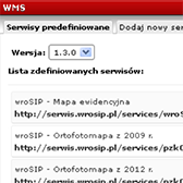
Poniższa lista dostępna jest także bezpośrednio na stronie serwisu >> w menu głównym (Plik -> Dodaj WMS).
https://serwis.wrosip.pl/gpservices/pzkOrto2009/MapServer/WMSServer – Orthophotomap 2009
https://serwis.wrosip.pl/gpservices/pzkOrto2012/MapServer/WMSServer – Orthophotomap 2012
https://serwis.wrosip.pl/gpservices/pzkOrto2014/MapServer/WMSServer – Orthophotomap 2014
https://serwis.wrosip.pl/gpservices/pzkOrto2017/MapServer/WMSServer – Orthophotomap 2017
https://serwis.wrosip.pl/gpservices/pzkOrto2020/MapServer/WMSServer – Orthophotomap 2020
https://ewid.wrosip.pl/iip/wms?SERVICE=WMS – Cadastral Map
https://serwis.wrosip.pl/gpservices/pzk_mz_wektor_wms/MapServer/WMSServer – Base topographic map
https://serwis.wrosip.pl/gpservices/wroSIP_Mapa_zasadnicza_WMS_raster/MapServer/WMSServer – Base topographic map – raster
https://serwis.wrosip.pl/gpservices/wroSIP_gminy_wms/MapServer/WMSServer – Boundaries of communes and districts Granice gmin i obrębów
https://serwis.wrosip.pl/gpservices/wroSIP_Podklad_uz/MapServer/WMSServer – Agricultural land
https://serwis.wrosip.pl/gpservices/wroSIP_analiza_WMS/MapServer/WMSServer – Ownership analysis
https://serwis.wrosip.pl/gpservices/pzkStudium/MapServer/WMSServer – Land Use Study
https://serwis.wrosip.pl/gpservices/wroSIP_MPZP_WMS/MapServer/WMSServer – Register and destination of the areas of local plans of municipalities of the Wrocław poviat
https://serwis.wrosip.pl/gpservices/wroSIP_ObszarRoznicaWysokosci/MapServer/WMSServer – Height differences to PL-EVRF2007-NH
https://serwis.wrosip.pl/gpservices/wroSIP_sekcje_hyb_WMS/MapServer/WMSServer – Cover with raster-vector map


;)
